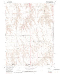
1962 Map of Trenton SE
USGS Topo · Published 1983About this map
The Nebraska-Kansas state line bisects this landscape where the high plains meet the intricate drainage systems of the Missouri River Basin. The southern edge of Swanson Lake is visible at the northern margin, while the terrain to the south is defined by deep incisions like Spring Canyon, Jones Canyon, and Black Canyon. These geological features overlook the broader valleys of Upper Driftwood and the North Fork Driftwood Creek. Local rural life is anchored by markers of the mid-century education system, including Ford Sch and School No 42. Evidence of energy exploration appears in several locations, with scattered Oil Wells and a Well situated within the elevated areas of Pleasant View and Freedom. The map captures a moment when the rural grid was still defined by these traditional names and early industrial incursions into the agrarian landscape.
Find a feature on this map
18 named features on this map. Tap any name to fly to it.
Don’t see what you’re looking for? This feature index may not catch every label — zoom into the map to look around manually.
Map Details
Editions of this 1962 Trenton SE Map
2 editions found
Other maps of this area

1951 · Herndon
USGS Topo · 1:62,500

1951 · Atwood
USGS Topo · 1:62,500

1954 · McCook
USGS Topo · 1:250,000

1954 · Goodland
USGS Topo · 1:250,000

1956 · Goodland
USGS Topo · 1:250,000

1957 · McCook
USGS Topo · 1:250,000

1957 · Goodland
USGS Topo · 1:250,000

1958 · McCook
USGS Topo · 1:250,000

1962 · Trenton
USGS Topo · 1:24,000

1962 · Trenton SW
USGS Topo · 1:24,000