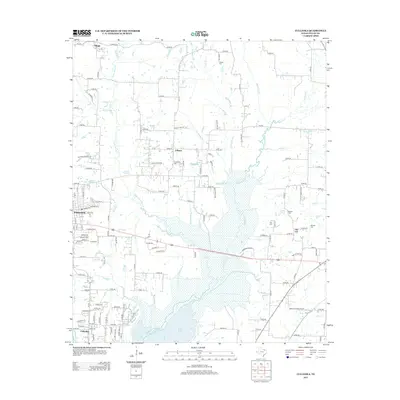
2013 Map of Culleoka
USGS Topo · Published 2013About this map
Lavon Lake dominates the southern landscape of this 2013 survey, where the rising waters of the reservoir reach into the bottomlands of Sister Grove Cr and Pilot Grove Cr. This modern topopgraphical record illustrates the urban expansion of Princeton and the smaller surrounding settlements like Culleoka, Climax, and Altoga. The map is particularly useful for genealogists, as it meticulously maintains the locations of several rural burial grounds, including Verona Cem, Van Winkle Cem, and Chapman Cem. Transportation routes such as FM-1827 and FM-1377 connect these communities, while private aviation landmarks like Jsi Airport and Mullins Landing Airport reflect the contemporary land use of the region. The intricate network of creeks, including Pot Rack Cr and Indian Cr, defines the drainage patterns into the primary reservoir basin.
Find a feature on this map
144 named features on this map. Tap any name to fly to it.
Don’t see what you’re looking for? This feature index may not catch every label — zoom into the map to look around manually.
Map Details
Editions of this 2013 Culleoka Map
This is the sole edition of this map. No revisions or reprints were ever made.
Other maps of this area

1924 · Farmersville 3-c
USGS Topo · 1:48,000

1924 · Mc Kinney 4-d
USGS Topo · 1:48,000

1929 · McKinney
USGS Topo · 1:62,500

1930 · Farmersville
USGS Topo · 1:62,500

1954 · Sherman
USGS Topo · 1:250,000

1958 · Sherman
USGS Topo · 1:250,000

1959 · Wylie
USGS Topo · 1:24,000

1960 · McKinney East
USGS Topo · 1:24,000

1960 · Blue Ridge
USGS Topo · 1:24,000

1960 · Pike
USGS Topo · 1:24,000