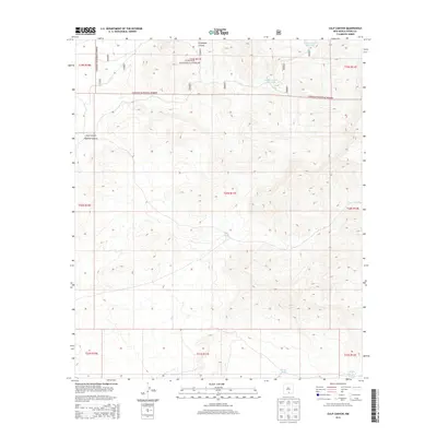
2013 Map of Culp Canyon
USGS Topo · Published 2013About this map
Lincoln National Forest land covers the northern portion of this map, where the high-altitude terrain of the Sacramento Mountains is incised by deep drainages. The landscape is defined by the complex relief of Grapevine Canyon, Culp Canyon, and Pipeline Canyon, which cut through the arid Otero County interior. This 2013 survey illustrates the critical role of water management in a desert environment, documented through isolated catchments and stock ponds like Upper Juniper Reservoir, Lower Juniper Reservoir, and the Middle Poe Tank near the southern boundary. While the terrain remains largely undeveloped, a network of Forest Service roads, including 5608 and 2030, provides access through the rugged canyons. This map offers a modern look at how resource management and topography intersect in the New Mexico backcountry.
Find a feature on this map
23 named features on this map. Tap any name to fly to it.
Don’t see what you’re looking for? This feature index may not catch every label — zoom into the map to look around manually.
Map Details
Editions of this 2013 Culp Canyon Map
This is the sole edition of this map. No revisions or reprints were ever made.
Other maps of this area

1943 · Pendejo Wash
USGS Topo · 1:62,500

1950 · Escondido Canyon
USGS Topo · 1:62,500

1954 · Carlsbad
USGS Topo · 1:250,000

1958 · Carlsbad
USGS Topo · 1:250,000

1965 · Rogers Ruins
USGS Topo · 1:24,000

1965 · El Paso Canyon
USGS Topo · 1:24,000

1979 · Alamogordo
USGS Topo · 1:100,000

1979 · Crow Flats
USGS Topo · 1:100,000
1980 · El Paso Draw
USGS Topo · 1:24,000
1980 · Wilde Tank
USGS Topo · 1:24,000