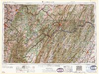
1961 Map of Cumberland
USGS Topo · Published 1961About this map
Cumberland serves as the focal point of this regional study, situated at the confluence of Wills Creek and the North Branch Potomac River. The landscape is dominated by the parallel ridges of the Allegheny Mountains, including prominent features such as Sideling Hill and Backbone Mountain. This era captures the expansive network of state and national forests, such as the Monongahela National Forest and Forbes State Forest, which preserve the timbered highlands between the industrial centers of the mid-Atlantic and the Ohio River Valley.
Find a feature on this map
54 named features on this map. Tap any name to fly to it.
Don’t see what you’re looking for? This feature index may not catch every label — zoom into the map to look around manually.
Map Details
Editions of this 1961 Cumberland Map
This is the sole edition of this map. No revisions or reprints were ever made.
Other maps of this area

1884 · Harpers Ferry
USGS Topo · 1:125,000

1886 · St. George
USGS Topo · 1:125,000

1889 · Beverly
USGS Topo · 1:125,000

1891 · Harpers Ferry
USGS Topo · 1:125,000

1891 · St. George
USGS Topo · 1:125,000

1891 · Romney
USGS Topo · 1:125,000

1892 · Beverly
USGS Topo · 1:125,000

1892 · Franklin
USGS Topo · 1:125,000

1892 · Woodstock
USGS Topo · 1:125,000

1893 · Buckhannon
USGS Topo · 1:125,000