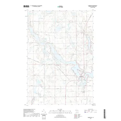
2018 Map of Cumberland
USGS Topo · Published 2018About this map
Beaver Dam Lake and its surrounding wetlands dominate this Barron County landscape, where the city of Cumberland sits surrounded by water. The local geography is defined by a dense concentration of glacial lakes, from Kirby Lake in the north to Scott Lake and Mud Lake in the south. The road network follows a rigid section-line grid, exemplified by numeric routes like 28th Ave and 21st Ave, which cut through the drainage basins of Sand Creek and the Hay River.
Find a feature on this map
82 named features on this map. Tap any name to fly to it.
Don’t see what you’re looking for? This feature index may not catch every label — zoom into the map to look around manually.
Map Details
Editions of this 2018 Cumberland Map
This is the sole edition of this map. No revisions or reprints were ever made.
Other maps of this area

1950 · Turtle Lake
USGS Topo · 1:62,500

1951 · Cumberland
USGS Topo · 1:48,000

1951 · Shell Lake
USGS Topo · 1:48,000

1951 · Barron
USGS Topo · 1:62,500

1952 · Turtle Lake
USGS Topo · 1:62,500

1953 · Rice Lake
USGS Topo · 1:250,000

1953 · Stillwater
USGS Topo · 1:250,000

1955 · Stillwater
USGS Topo · 1:250,000

1956 · Cumberland
USGS Topo · 1:62,500

1958 · Stillwater
USGS Topo · 1:250,000