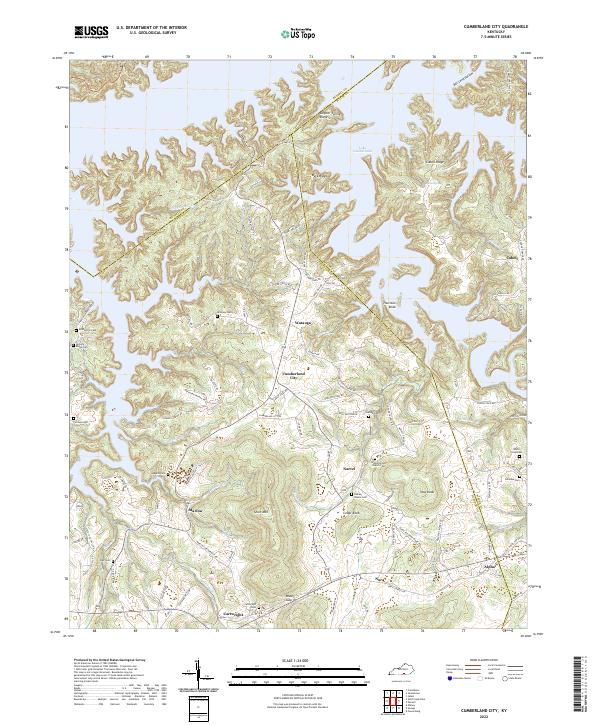
2022 Map of Cumberland City
USGS Topo · Published 2022About this map
Lake Cumberland dominates the northern reaches of this landscape, its indented shoreline carving through ridges and hollows along the Clinton and Wayne County border. The map reveals a distribution of rural settlements including Cumberland City, Watauga, and Marlow, which are connected by a network of winding roads like Marlow Cartwright Rd and Fryman Landing Rd. The terrain is characterized by prominent elevations such as Thurston Knob, Haw Knob, and Cedar Knob, interspersed with family-named cemeteries that speak to the area's ancestral roots.
Find a feature on this map
99 named features on this map. Tap any name to fly to it.
Don’t see what you’re looking for? This feature index may not catch every label — zoom into the map to look around manually.
Map Details
Editions of this 2022 Cumberland City Map
This is the sole edition of this map. No revisions or reprints were ever made.
Other maps of this area

1911 · Monticello
USGS Topo · 1:62,500

1914 · Monticello
USGS Topo · 1:62,500

1929 · Byrdstown
USGS Topo · 1:62,500

1934 · Pall Mall
USGS Topo · 1:62,500

1953 · Parnell
USGS Topo · 1:24,000

1953 · Wolf Creek Dam
USGS Topo · 1:24,000

1953 · Creelsboro
USGS Topo · 1:24,000

1953 · Jamestown
USGS Topo · 1:24,000

1954 · Jabez
USGS Topo · 1:24,000

1954 · Cumberland City
USGS Topo · 1:24,000