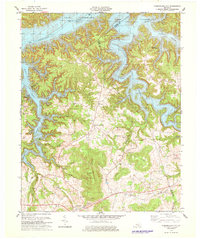
1978 Map of Cumberland City
USGS Topo · Published 1978About this map
Lake Cumberland dominates the northern landscape of this Kentucky survey, where the impounded waters of the Cumberland River snake through deep-cut valleys. The shoreline is characterized by numerous flooded inlets such as Indian Creek and Otter Creek, reflecting the transformation of the terrain following the completion of the Wolf Creek Dam. High points like Haw Knob and Short Mountain rise above the branching waterways, providing a glimpse into the original topography of Clinton and Wayne Counties.
Find a feature on this map
55 named features on this map. Tap any name to fly to it.
Don’t see what you’re looking for? This feature index may not catch every label — zoom into the map to look around manually.
Map Details
Editions of this 1978 Cumberland City Map
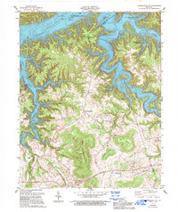
2 editions found
Other maps of this area

1911 · Monticello
USGS Topo · 1:62,500

1914 · Monticello
USGS Topo · 1:62,500

1929 · Byrdstown
USGS Topo · 1:62,500

1934 · Pall Mall
USGS Topo · 1:62,500

1953 · Parnell
USGS Topo · 1:24,000

1953 · Wolf Creek Dam
USGS Topo · 1:24,000

1953 · Creelsboro
USGS Topo · 1:24,000

1953 · Jamestown
USGS Topo · 1:24,000

1954 · Jabez
USGS Topo · 1:24,000

1954 · Cumberland City
USGS Topo · 1:24,000