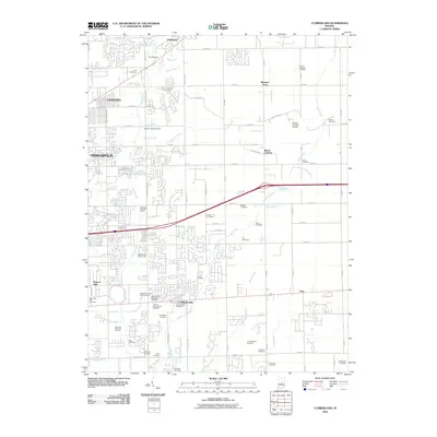
2010 Map of Cumberland
USGS Topo · Published 2010About this map
Cumberland and the eastern outskirts of Indianapolis are defined by a complex network of suburban expansion and a high density of ancestral burial grounds. This 2010 survey illustrates the transition from urban density in Warren Hills and Lawrence to the more dispersed residential patterns of Gem and Pleasant Acres. The landscape is heavily marked by local family and community history, evidenced by numerous small cemeteries such as the Witte Cemetery, Kitley Cemetery, and Luebking Cemetery. Significant green spaces are provided by the Augusta Hills Golf Course and Maple Creek Golf Course. The area is drained by a dense web of waterways, including Buck Creek, Grassy Creek, and numerous man-made features like Burris Ditch and Rothe Ditch, reflecting the historical management of the region's low-lying terrain.
Find a feature on this map
107 named features on this map. Tap any name to fly to it.
Don’t see what you’re looking for? This feature index may not catch every label — zoom into the map to look around manually.
Map Details
Editions of this 2010 Cumberland Map
This is the sole edition of this map. No revisions or reprints were ever made.
Other maps of this area

1948 · Indianapolis East
USGS Topo · 1:24,000

1948 · Beech Grove
USGS Topo · 1:24,000

1952 · Cumberland
USGS Topo · 1:24,000

1952 · Greenfield
USGS Topo · 1:24,000

1952 · Fountaintown
USGS Topo · 1:24,000

1952 · Fishers
USGS Topo · 1:24,000

1952 · Ingalls
USGS Topo · 1:24,000

1952 · Mc Cordsville
USGS Topo · 1:24,000

1953 · Acton
USGS Topo · 1:24,000

1953 · Cincinnati
USGS Topo · 1:250,000