2023 Map of Cumberland
USGS Topo · Published 2023About this map
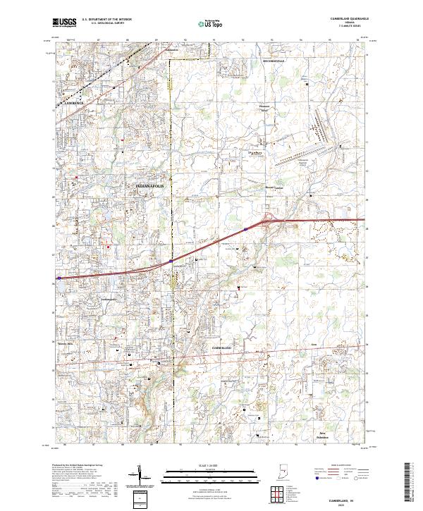
Cumberland sits as a central hub in this survey of the suburban and rural landscape where eastern Marion County meets Hancock County. The map documents a dense network of family and community history, particularly through its numerous burial grounds such as the Saint John United Church of Christ Cem, Langenberger Cem, and the German Church Road Cem. These sites, along with smaller family markers like the Witte Cem and Luebking Cem, provide a detailed record for genealogical research in an area transitioning from its agricultural roots to residential expansion.
Find a feature on this map
245 named features on this map. Tap any name to fly to it.
Don’t see what you’re looking for? This feature index may not catch every label — zoom into the map to look around manually.
Map Details
Editions of this 2023 Cumberland Map
This is the sole edition of this map. No revisions or reprints were ever made.
Historical Maps of Indianapolis Through Time
3 maps found