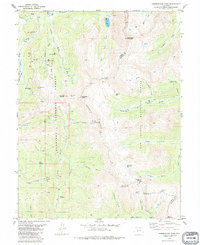
1982 Map of Cumberland Pass
USGS Topo · Published 1987About this map
The high peaks of the Continental Divide define this 1982 survey, where the mining history of the Gunnison and San Isabel national forests is etched into the landscape. High-altitude mining operations are concentrated near the northern border, including the Old Gold Cup Mine and Blistered Horn Mine, while the southern reaches feature the remnants of the Denver, South Park and Pacific Railroad. A notable concentration of historical markers exists near the townsite of Tincup, including the Tincup Cem and the evocatively named Boothill Cem.
Find a feature on this map
67 named features on this map. Tap any name to fly to it.
Don’t see what you’re looking for? This feature index may not catch every label — zoom into the map to look around manually.
Map Details
Editions of this 1982 Cumberland Pass Map
2 editions found
Other maps of this area

1934 · Taylor Park
USGS Topo · 1:62,500

1937 · Taylor Park
USGS Topo · 1:62,500

1940 · Garfield
USGS Topo · 1:62,500

1941 · Pitkin
USGS Topo · 1:62,500

1945 · Pitkin
USGS Topo · 1:62,500

1945 · Garfield
USGS Topo · 1:62,500

1955 · Mount Harvard
USGS Topo · 1:62,500

1956 · Montrose
USGS Topo · 1:250,000

1959 · Montrose
USGS Topo · 1:250,000

1960 · Montrose
USGS Topo · 1:250,000