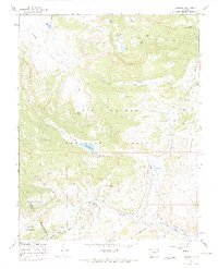
1967 Map of Cumbres
USGS Topo · Published 1969About this map
The Denver and Rio Grande Western Railroad defines the southern reach of this survey, winding through the high mountain passes near the border of Conejos and Archuleta counties. This 1967 field-checked sheet captures the vital transportation corridor at Cumbres Pass, featuring the small settlement of Cumbres and a critical Snow Shed positioned to protect the rails from winter drifts.
Find a feature on this map
45 named features on this map. Tap any name to fly to it.
Don’t see what you’re looking for? This feature index may not catch every label — zoom into the map to look around manually.
Map Details
Editions of this 1967 Cumbres Map
4 editions found
Other maps of this area

1913 · Summitville
USGS Topo · 1:125,000

1915 · Summitville
USGS Topo · 1:125,000

1918 · Tusas
USGS Topo · 1:125,000

1922 · Conejos
USGS Topo · 1:125,000

1945 · Durango
USGS Topo · 1:250,000

1953 · Durango
USGS Topo · 1:250,000

1954 · Durango
USGS Topo · 1:250,000

1954 · Aztec
USGS Topo · 1:250,000

1955 · Chama
USGS Topo · 1:62,500

1955 · Brazos Peak
USGS Topo · 1:62,500