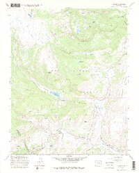
1967 Map of Cumbres
USGS Topo · Published 1975About this map
The Denver and Rio Grande Western narrow gauge railroad winds through this high-altitude landscape of the Rio Grande National Forest, cresting the continent at Cumbres Pass. This 1967 field-checked survey highlights the critical infrastructure of the rail line, including the essential Snow Shed and a Water Tank near the settlement of Cumbres. The terrain is defined by rugged peaks such as Neff Mountain and Jarosa Peak, with numerous water sources like Trujillo Meadows Reservoir and Waterdog Lake feeding into the Rio de los Pinos.
Find a feature on this map
42 named features on this map. Tap any name to fly to it.
Don’t see what you’re looking for? This feature index may not catch every label — zoom into the map to look around manually.
Map Details
Editions of this 1967 Cumbres Map
4 editions found
Other maps of this area

1913 · Summitville
USGS Topo · 1:125,000

1915 · Summitville
USGS Topo · 1:125,000

1918 · Tusas
USGS Topo · 1:125,000

1922 · Conejos
USGS Topo · 1:125,000

1945 · Durango
USGS Topo · 1:250,000

1953 · Durango
USGS Topo · 1:250,000

1954 · Durango
USGS Topo · 1:250,000

1954 · Aztec
USGS Topo · 1:250,000

1955 · Chama
USGS Topo · 1:62,500

1955 · Brazos Peak
USGS Topo · 1:62,500