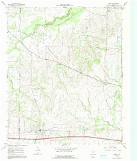
1964 Map of Cumby
USGS Topo · Published 1991About this map
Cumby serves as the primary hub in this Texas landscape where the boundaries of Hunt, Delta, and Hopkins counties converge. Recorded in the mid-1960s, the map reveals a rural economy organized around the St Louis Southwestern railroad line and the newly established Interstate 30, which cuts a straight path through the southern portion of the quadrangle. Smaller rural centers like Ridgeway and Branom are tied together by a network of unimproved roads and fence lines, suggesting a territory still deeply rooted in agriculture.
Find a feature on this map
21 named features on this map. Tap any name to fly to it.
Don’t see what you’re looking for? This feature index may not catch every label — zoom into the map to look around manually.
Map Details
Editions of this 1964 Cumby Map
2 editions found
Other maps of this area

1953 · Texarkana
USGS Topo · 1:250,000

1956 · Texarkana
USGS Topo · 1:250,000

1962 · Lone Oak North
USGS Topo · 1:24,000

1962 · Miller Grove
USGS Topo · 1:24,000

1962 · Brashear
USGS Topo · 1:24,000

1964 · Cumby
USGS Topo · 1:24,000

1964 · Commerce South
USGS Topo · 1:24,000

1964 · Gafford Chapel
USGS Topo · 1:24,000

1964 · Klondike
USGS Topo · 1:24,000

1964 · Commerce North
USGS Topo · 1:24,000