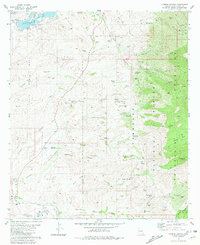
1981 Map of Cumero Canyon
USGS Topo · Published 1981About this map
Patagonia Lake State Park and the surrounding high desert terrain dominate this early 1980s survey of southern Arizona. The landscape is defined by a complex network of canyons including Fresno Canyon, Cumero Canyon, and Providencia Canyon, which channel toward the Santa Cruz River in the south. The map documents a transition from the agricultural and ranching history of the Circle Z Ranch and T 4 Ranch to the industrial legacy of the Patagonia Mountains.
Find a feature on this map
86 named features on this map. Tap any name to fly to it.
Don’t see what you’re looking for? This feature index may not catch every label — zoom into the map to look around manually.
Map Details
Editions of this 1981 Cumero Canyon Map
3 editions found
Other maps of this area

1904 · Patagonia
USGS Topo · 1:125,000

1905 · Patagonia
USGS Topo · 1:125,000

1905 · Nogales
USGS Topo · 1:125,000

1922 · Agus Caliente
USGS Topo · 1:62,500

1932 · Lochiel
USGS Topo · 1:62,500

1932 · Elgin
USGS Topo · 1:62,500

1933 · Calabasas
USGS Topo · 1:62,500

1940 · Elgin
USGS Topo · 1:62,500

1947 · Elgin
USGS Topo · 1:62,500

1948 · Harshaw
USGS Topo · 1:24,000