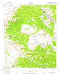
1943 Map of Cummings Mountain
USGS Topo · Published 1958About this map
Bear Mountain and the surrounding high country of the Tehachapi range dominate this landscape as it appeared in the mid-1940s. The topographic data reveals a complex network of ranching and specialized institutions, including the Stonybrook Retreat, the Kern Co Preventorium, and the California Institution For Women (Abandoned). These facilities were situated in the relatively isolated basins of Bear Valley and Cummings Valley, where early-century development was often tied to climate and seclusion.
Find a feature on this map
45 named features on this map. Tap any name to fly to it.
Don’t see what you’re looking for? This feature index may not catch every label — zoom into the map to look around manually.
Map Details
Editions of this 1943 Cummings Mountain Map
5 editions found

Other maps of this area

1903 · Tejon
USGS Topo · 1:125,000

1914 · Caliente
USGS Topo · 1:125,000

1915 · Elizabeth Lake
USGS Topo · 1:125,000

1915 · Mojave
USGS Topo · 1:125,000

1917 · Elizabeth Lake
USGS Topo · 1:125,000

1929 · Bena
USGS Topo · 1:31,680

1930 · Bear Mountain
USGS Topo · 1:31,680

1930 · Arvin
USGS Topo · 1:31,680

1931 · Edison
USGS Topo · 1:31,680

1931 · Tejon Hills
USGS Topo · 1:31,680