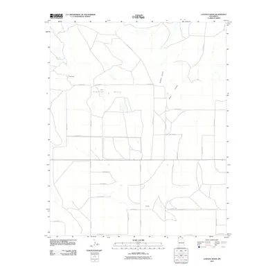
2010 Map of Cunavea Basin
USGS Topo · Published 2010About this map
Cunavea Basin forms a natural depression in this portion of Quay County, defined by a network of rural roads and seasonal watercourses. The landscape is marked by small settlements such as Lyons and Shoemaker in the northern reaches, while Jennings sits toward the south. The terrain is further shaped by Hartford Canyon and Long Canyon, which channel drainage through the basin floor. This 2010 survey by the U.S. Geological Survey illustrates a highly organized grid system of Quay County roads, including Quay Road 38 and Quay Road 34, which serve the agricultural and ranching interests of the region. Local landmarks like Alamo Spring provide evidence of the scattered water sources critical to this arid New Mexico environment.
Find a feature on this map
25 named features on this map. Tap any name to fly to it.
Don’t see what you’re looking for? This feature index may not catch every label — zoom into the map to look around manually.
Map Details
Editions of this 2010 Cunavea Basin Map
This is the sole edition of this map. No revisions or reprints were ever made.
Other maps of this area

1954 · Fort Sumner
USGS Topo · 1:250,000

1954 · Clovis
USGS Topo · 1:250,000

1958 · Fort Sumner
USGS Topo · 1:250,000

1958 · Clovis
USGS Topo · 1:250,000

1968 · Hassell
USGS Topo · 1:24,000

1968 · Ima SE
USGS Topo · 1:24,000
1968 · Ima
USGS Topo · 1:24,000

1970 · Jordan
USGS Topo · 1:24,000

1970 · Quay
USGS Topo · 1:24,000
1970 · Circles S Mesa
USGS Topo · 1:24,000