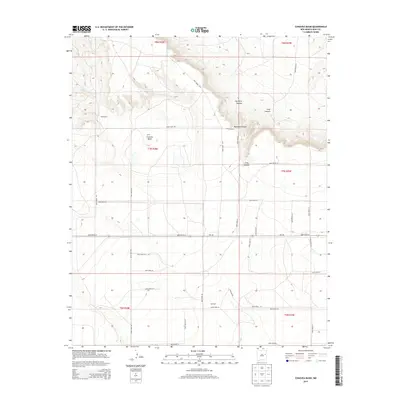
2013 Map of Cunavea Basin
USGS Topo · Published 2013About this map
The high plains of eastern New Mexico unfold across this 2013 survey of Cunavea Basin. This landscape is defined by the dramatic descent from the mesa into the basin floor, where topographic relief is provided by Hartford Canyon and Long Canyon. Sparse settlement is anchored by Shoemaker, while the surrounding ranching country is accessed by a geometric grid of county roads and NM-156. Water sources, critical for survival in this arid environment, are specifically marked at Hart Springs in the north and Alamo Spring to the west. The map illustrates the contemporary persistence of the Public Land Survey System, with township and range lines like t7n r28e and t7n r29e dictating the placement of secondary thoroughfares such as Quay Road 40 and Quay Road 37.
Find a feature on this map
34 named features on this map. Tap any name to fly to it.
Don’t see what you’re looking for? This feature index may not catch every label — zoom into the map to look around manually.
Map Details
Editions of this 2013 Cunavea Basin Map
This is the sole edition of this map. No revisions or reprints were ever made.
Other maps of this area

1954 · Fort Sumner
USGS Topo · 1:250,000

1954 · Clovis
USGS Topo · 1:250,000

1958 · Fort Sumner
USGS Topo · 1:250,000

1958 · Clovis
USGS Topo · 1:250,000

1968 · Hassell
USGS Topo · 1:24,000

1968 · Ima SE
USGS Topo · 1:24,000
1968 · Ima
USGS Topo · 1:24,000

1970 · Jordan
USGS Topo · 1:24,000

1970 · Quay
USGS Topo · 1:24,000
1970 · Circles S Mesa
USGS Topo · 1:24,000