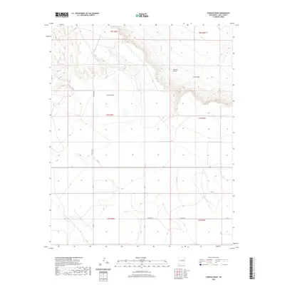
2020 Map of Cunavea Basin
USGS Topo · Published 2020About this map
Cunavea Basin defines this high plains landscape of eastern New Mexico, where the terrain transitions from flat-topped mesas into deep drainage systems. The northern portion of the map is defined by the significant topographic relief of Hartford Canyon and Long Canyon, which cut through the escarpment. These geological features contrast sharply with the broad, open basin to the south, where a grid of rural routes like Quay Road BE and Pasture Rd provides access across the arid terrain.
Find a feature on this map
21 named features on this map. Tap any name to fly to it.
Don’t see what you’re looking for? This feature index may not catch every label — zoom into the map to look around manually.
Map Details
Editions of this 2020 Cunavea Basin Map
This is the sole edition of this map. No revisions or reprints were ever made.
Other maps of this area

1954 · Fort Sumner
USGS Topo · 1:250,000

1954 · Clovis
USGS Topo · 1:250,000

1958 · Fort Sumner
USGS Topo · 1:250,000

1958 · Clovis
USGS Topo · 1:250,000

1968 · Hassell
USGS Topo · 1:24,000

1968 · Ima SE
USGS Topo · 1:24,000
1968 · Ima
USGS Topo · 1:24,000

1970 · Jordan
USGS Topo · 1:24,000

1970 · Quay
USGS Topo · 1:24,000
1970 · Circles S Mesa
USGS Topo · 1:24,000