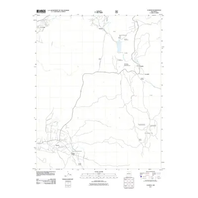
2011 Map of Cundiyo
USGS Topo · Published 2011About this map
Nambe Pueblo and the surrounding Nambe Archaeological District anchor the southwestern portion of this landscape, where Tewa-language street names like Poechunu Poe and Povipin Poe reflect the deep cultural heritage of the Pojoaque Creek drainage. The terrain rises toward the northeast, following the courses of the Rio Medio and Rio Frijoles as they converge near the settlement of Cundiyo.
Find a feature on this map
51 named features on this map. Tap any name to fly to it.
Don’t see what you’re looking for? This feature index may not catch every label — zoom into the map to look around manually.
Map Details
Editions of this 2011 Cundiyo Map
This is the sole edition of this map. No revisions or reprints were ever made.
Other maps of this area

1889 · Santa Fe
USGS Topo · 1:125,000

1892 · Santa Clara
USGS Topo · 1:125,000

1894 · Santa Fe
USGS Topo · 1:125,000

1918 · Abiquiu
USGS Topo · 1:125,000

1953 · Tesuque
USGS Topo · 1:24,000

1953 · Espanola
USGS Topo · 1:24,000

1953 · San Juan Pueblo
USGS Topo · 1:24,000

1953 · Horcado Ranch
USGS Topo · 1:24,000

1953 · Truchas
USGS Topo · 1:24,000

1953 · Sierra Mosca
USGS Topo · 1:24,000