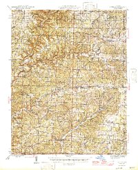
1946 Map of Cureall
USGS Topo · Published 1946About this map
Bakersfield and the surrounding rural landscape of Richland and Spring Creek townships reflect a post-war agricultural community defined by its remote springs and river crossings. This mid-century survey captures the region just before modern infrastructure reshaped the Ozarks, showing a high density of one-room schoolhouses like Oak Mound Sch and Lone Pilgrim Sch. Water access was vital to the local economy, evidenced by the presence of Breakup Mill and numerous named fords such as Casey Ford and Double Spring Ford crossing the Bennett Bayou. The social fabric of the era is preserved through numerous small congregations and burying grounds, including Baptist Hill Ch and the Pottersville Cem, while the northern portion of the map encompasses a section of the Mark Twain National Forest.
Find a feature on this map
79 named features on this map. Tap any name to fly to it.
Don’t see what you’re looking for? This feature index may not catch every label — zoom into the map to look around manually.
Map Details
Editions of this 1946 Cureall Map
2 editions found

Other maps of this area

1890 · Mountain Home
USGS Topo · 1:125,000

1891 · Mountain Home
USGS Topo · 1:125,000

1894 · Mountain Home
USGS Topo · 1:125,000

1934 · Gainesville
USGS Topo · 1:48,000

1937 · Buckhart
USGS Topo · 1:48,000

1939 · Topaz
USGS Topo · 1:62,500

1940 · Gainesville
USGS Topo · 1:62,500

1941 · Topaz
USGS Topo · 1:62,500

1943 · Buckhart
USGS Topo · 1:62,500

1944 · West Plains
USGS Topo · 1:62,500