
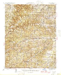
1946 Map of Cureall
USGS Topo · Published 1946About this map
Bakersfield and Pottersville anchor this mid-1940s landscape of the Missouri-Arkansas border, where the Ozark Highlands are deeply dissected by the North Fork White River and Spring Creek. The area is characterized by an exceptionally dense network of rural one-room schools, such as Hawkins Ridge School, Vienna School, and Mt Pleasant School, many of which served localized farming communities that have since consolidated. A single industrial outlier, the Alice Mine, sits among the ridges, while spiritual life is anchored by landmarks like Cold Springs Church and the Cureall Cemetery.
Find a feature on this map
130 named features on this map. Tap any name to fly to it.
Don’t see what you’re looking for? This feature index may not catch every label — zoom into the map to look around manually.
Map Details
Editions of this 1946 Cureall Map
2 editions found
Other maps of this area

1890 · Mountain Home
USGS Topo · 1:125,000

1891 · Mountain Home
USGS Topo · 1:125,000

1894 · Mountain Home
USGS Topo · 1:125,000

1934 · Gainesville
USGS Topo · 1:48,000

1937 · Buckhart
USGS Topo · 1:48,000

1939 · Topaz
USGS Topo · 1:62,500

1940 · Gainesville
USGS Topo · 1:62,500

1941 · Topaz
USGS Topo · 1:62,500

1943 · Buckhart
USGS Topo · 1:62,500

1944 · West Plains
USGS Topo · 1:62,500