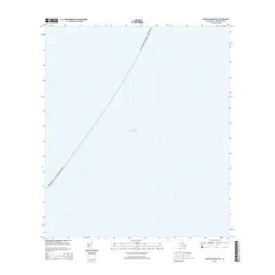
2015 Map of Curlew Islands OE E
USGS Topo · Published 2015About this map
The Gulf of Mexico dominates this nautical expanse, representing a remote stretch of the outer Louisiana coastline. Defined primarily by the maritime boundary of St. Bernard Parish, this area serves as a critical point of geographic reference for the marshy fringes of the Mississippi River Delta. While the map is predominantly open water, it precisely delineates the administrative limits of Louisiana, providing an essential record of territorial waters and coastal jurisdiction in the early 21st century. The simplicity of the terrain reflects the fluid and shifting nature of the state's southeastern extremity, where the land and sea meet in a complex, ever-changing environment.
Find a feature on this map
3 named features on this map. Tap any name to fly to it.
Don’t see what you’re looking for? This feature index may not catch every label — zoom into the map to look around manually.
Map Details
Editions of this 2015 Curlew Islands OE E Map
This is the sole edition of this map. No revisions or reprints were ever made.
Other maps of this area

1951 · New Harbor Islands
USGS Topo · 1:24,000
1951 · Stake Islands
USGS Topo · 1:24,000

1957 · Breton Sound
USGS Topo · 1:250,000

1961 · Breton Sound
USGS Topo · 1:250,000

1982 · North Islands
USGS Topo · 1:100,000
1998 · New Harbor Islands
USGS Topo · 1:24,000
2012 · Curlew Islands
USGS Topo · 1:24,000
2012 · Freemason Island
USGS Topo · 1:24,000
2012 · Curlew Islands OE E
USGS Topo · 1:24,000
2012 · Grand Gosier Islands OE E
USGS Topo · 1:24,000