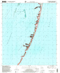
1998 Map of New Harbor Islands
USGS Topo · Published 2001About this map
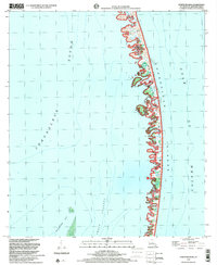
Breton National Wildlife Refuge encompasses the fragile, shifting chain of the Chandeleur Islands in this late-twentieth-century study of the Louisiana coast. This maritime landscape is defined by its isolation from the mainland, consisting of sandy barrier features like North Islands and the New Harbor Islands that protect the inner waters of Shoalwater Bay. The map records a critical moment for the region’s geography, as the margin notes this quadrangle covers a subsidence area, where the very land is slowly sinking into the Gulf of Mexico. Despite the conservation status of the refuge, human activity is present in the form of industrial Platforms and a Platform situated within the Smack Channel, marking the intersection of natural preservation and offshore resource extraction at the end of the 1990s.
Find a feature on this map
11 named features on this map. Tap any name to fly to it.
Don’t see what you’re looking for? This feature index may not catch every label — zoom into the map to look around manually.
Map Details
Editions of this 1998 New Harbor Islands Map
This is the sole edition of this map. No revisions or reprints were ever made.
Other maps of this area

1951 · North Islands
USGS Topo · 1:24,000

1951 · New Harbor Islands
USGS Topo · 1:24,000
1951 · Stake Islands
USGS Topo · 1:24,000
1951 · Freemason Island
USGS Topo · 1:24,000

1957 · Breton Sound
USGS Topo · 1:250,000

1961 · Breton Sound
USGS Topo · 1:250,000

1982 · North Islands
USGS Topo · 1:100,000
1998 · Freemason Island
USGS Topo · 1:24,000
1998 · North Islands
USGS Topo · 1:24,000
2012 · Curlew Islands
USGS Topo · 1:24,000