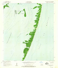
1951 Map of New Harbor Islands
USGS Topo · Published 1958About this map
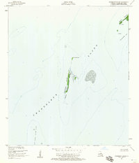
The Chandeleur Islands stretch across this coastal survey, forming a delicate barrier between the open Gulf of Mexico and the inner waters of Breton Sound. Much of this island chain and the nearby New Harbor Islands are protected within the Breton National Wildlife Refuge, highlighting the ecological significance of this remote marsh and beach environment in the early 1950s. The map provides precise bathymetric data, tracing the depths of Smack Channel and the shallow reaches of Shoalwater Bay. Notable landmarks such as Redfish Point and the North Islands serve as critical reference points for mariners navigating the shifting sands and inlets of the Louisiana coast. This record documents the shoreline profile as it existed before decades of coastal erosion and tropical storms further reshaped the archipelago.
Find a feature on this map
11 named features on this map. Tap any name to fly to it.
Don’t see what you’re looking for? This feature index may not catch every label — zoom into the map to look around manually.
Map Details
Editions of this 1951 New Harbor Islands Map
3 editions found

Other maps of this area
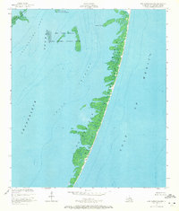
1951 · North Islands
USGS Topo · 1:24,000
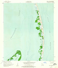
1951 · Stake Islands
USGS Topo · 1:24,000
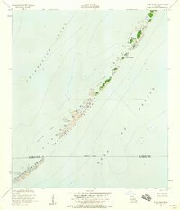
1951 · Freemason Island
USGS Topo · 1:24,000

1957 · Breton Sound
USGS Topo · 1:250,000

1961 · Breton Sound
USGS Topo · 1:250,000

1982 · North Islands
USGS Topo · 1:100,000

1998 · New Harbor Islands
USGS Topo · 1:24,000

1998 · Freemason Island
USGS Topo · 1:24,000

1998 · North Islands
USGS Topo · 1:24,000

2012 · Curlew Islands
USGS Topo · 1:24,000