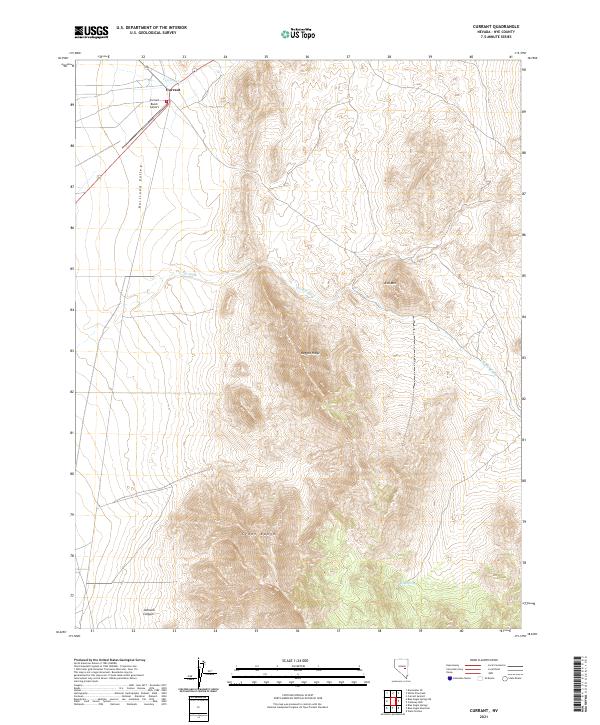
2021 Map of Currant
USGS Topo · Published 2021About this map
Currant sits at the northern edge of this high-desert landscape in Nye County, where the sprawling Railroad Valley meets the rising elevations of the Grant Range. The settlement's proximity to Currant Cr and the presence of the Currant Ranch Airport suggest its role as a remote hub for regional aviation and ranching. The terrain is defined by dramatic geological features, including the steep slopes of Red Mtn and the prominent Ragged Ridge, which overlook the seasonal drainage of The Big Wash. To the south, the deep incision of Johnson Canyon cuts into the mountain front, while isolated water sources like Blind Spring provide rare points of relief in an otherwise arid environment. This topographic study documents the complex intersection of alluvial fans and mountain ridges that characterize this section of central Nevada.
Find a feature on this map
14 named features on this map. Tap any name to fly to it.
Don’t see what you’re looking for? This feature index may not catch every label — zoom into the map to look around manually.
Map Details
Editions of this 2021 Currant Map
This is the sole edition of this map. No revisions or reprints were ever made.
Other maps of this area

1956 · Lund
USGS Topo · 1:250,000

1957 · Currant Mtn
USGS Topo · 1:62,500

1960 · Lund
USGS Topo · 1:250,000

1964 · Blue Eagle Springs
USGS Topo · 1:62,500

1964 · Duckwater
USGS Topo · 1:62,500

1964 · Currant
USGS Topo · 1:62,500

1964 · Currant Mtn
USGS Topo · 1:62,500

1980 · Duckwater
USGS Topo · 1:100,000
1990 · Wells Station
USGS Topo · 1:24,000
1990 · Currant
USGS Topo · 1:24,000