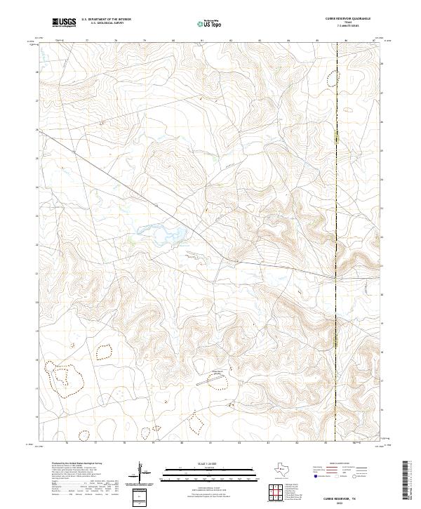
2022 Map of Currie Reservoir
USGS Topo · Published 2022About this map
Currie Reservoir lies at the heart of this West Texas landscape, serving as a primary water source in a region defined by intermittent drainage. The surrounding terrain is carved by numerous creek beds, including Fool Cr, Lacy Creek, and Lucy Cr, which follow the natural contours toward the eastern county line. This area on the border of Glasscock and Sterling counties reflects the specialized needs of modern ranching and rural operations, centered on large-scale land management and localized infrastructure.
Find a feature on this map
12 named features on this map. Tap any name to fly to it.
Don’t see what you’re looking for? This feature index may not catch every label — zoom into the map to look around manually.
Map Details
Editions of this 2022 Currie Reservoir Map
This is the sole edition of this map. No revisions or reprints were ever made.
Other maps of this area

1954 · San Angelo
USGS Topo · 1:250,000

1958 · San Angelo
USGS Topo · 1:250,000

1963 · Glass Ranch
USGS Topo · 1:24,000

1963 · Ballinger Ranch
USGS Topo · 1:24,000

1963 · Currie Reservoir
USGS Topo · 1:24,000

1963 · Garden City NE
USGS Topo · 1:24,000
1963 · Sand Bluff Draw
USGS Topo · 1:24,000

1963 · Garden City
USGS Topo · 1:24,000

1965 · San Angelo
USGS Topo · 1:250,000

1973 · Three Bluff Draw NE
USGS Topo · 1:24,000