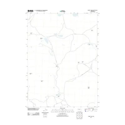
2011 Map of Curry Lake
USGS Topo · Published 2011About this map
French Valley and the surrounding Nebraska Sandhills are defined by a complex network of named basins and ranching operations captured in this 2011 survey. The landscape is dotted with several distinct depressions and drainages, including Julian Valley, Double Supply Valley, and Anderson Valley. These geographical features influenced the placement of remote ranching headquarters such as the Open Box Arrow Ranch and the Sutton N- Arrow Ranch. The central water feature, Curry Lake, sits nestled near the junction of several local routes, illustrating how water and topography dictated the settlement patterns of Garden County. Roads such as S Ashby Rd and Road 209 provide the primary infrastructure through this sparsely populated cattle-country terrain, connecting isolated homesteads like the Farm Valley Ranch to the wider region.
Find a feature on this map
19 named features on this map. Tap any name to fly to it.
Don’t see what you’re looking for? This feature index may not catch every label — zoom into the map to look around manually.
Map Details
Editions of this 2011 Curry Lake Map
This is the sole edition of this map. No revisions or reprints were ever made.
Other maps of this area

1948 · George Lake
USGS Topo · 1:62,500

1949 · Rackett
USGS Topo · 1:62,500

1950 · Velma
USGS Topo · 1:62,500

1950 · George Lake
USGS Topo · 1:62,500

1950 · Longfellow Lake
USGS Topo · 1:62,500

1951 · Rackett
USGS Topo · 1:62,500

1954 · Scottsbluff
USGS Topo · 1:250,000

1954 · North Platte
USGS Topo · 1:250,000

1956 · North Platte
USGS Topo · 1:250,000

1957 · North Platte
USGS Topo · 1:250,000