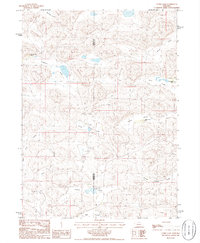
1986 Map of Curry Lake
USGS Topo · Published 1986About this map
Curry Lake and a complex system of interconnected sandhills valleys characterize this mid-1980s landscape on the Garden Co Grant Co line. The terrain is defined by a dense network of named depressions, including Double Supply Valley, French Valley, and Leech Valley, which illustrate the unique hydrology of the Nebraska Sandhills where water often collects in these low-lying pockets. Settlement is sparse and primarily tied to large ranching operations. Significant landmarks for local history and genealogy include the Open Box Arrow Ranch in the northwest, Farm Valley Ranch to the east, and the Sutton N-Arrow Ranch located near the center of the quadrangle. These ranch names reflect long-standing cattle brands and landholdings in the region, while the presence of a Flowing Well indicates the essential role of groundwater in sustaining livestock in this semi-arid environment.
Find a feature on this map
20 named features on this map. Tap any name to fly to it.
Don’t see what you’re looking for? This feature index may not catch every label — zoom into the map to look around manually.
Map Details
Editions of this 1986 Curry Lake Map
This is the sole edition of this map. No revisions or reprints were ever made.
Other maps of this area

1948 · George Lake
USGS Topo · 1:62,500

1949 · Rackett
USGS Topo · 1:62,500

1950 · Velma
USGS Topo · 1:62,500

1950 · George Lake
USGS Topo · 1:62,500

1950 · Longfellow Lake
USGS Topo · 1:62,500

1951 · Rackett
USGS Topo · 1:62,500

1954 · Scottsbluff
USGS Topo · 1:250,000

1954 · North Platte
USGS Topo · 1:250,000

1956 · North Platte
USGS Topo · 1:250,000

1957 · North Platte
USGS Topo · 1:250,000