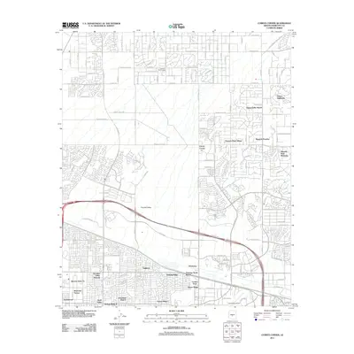
2011 Map of Currys Corner
USGS Topo · Published 2011About this map
Currys Corner sits at the heart of this North Phoenix and Scottsdale landscape, showing the intensive residential expansion across the Maricopa County desert in the early twenty-first century. The map details a transition from planned luxury enclaves like Desert Highlands and Happy Valley Ranch in the north to dense suburban developments such as Desert Ridge and Basking Ridge further south. This era of growth is defined by a grid of major thoroughfares including E Dynamite Blvd and E Happy Valley Rd, which facilitate movement between the desert foothills and the urban core.
Find a feature on this map
59 named features on this map. Tap any name to fly to it.
Don’t see what you’re looking for? This feature index may not catch every label — zoom into the map to look around manually.
Map Details
Editions of this 2011 Currys Corner Map
This is the sole edition of this map. No revisions or reprints were ever made.
Other maps of this area

1904 · Camelback
USGS Topo · 1:62,500

1906 · Camelsback
USGS Topo · 1:62,500

1930 · Cave Creek
USGS Topo · 1:125,000

1939 · Cave Creek
USGS Topo · 1:125,000

1954 · Phoenix
USGS Topo · 1:250,000

1954 · Mesa
USGS Topo · 1:250,000

1957 · Mesa
USGS Topo · 1:250,000

1957 · Phoenix
USGS Topo · 1:250,000

1958 · Mesa
USGS Topo · 1:250,000

1958 · Phoenix
USGS Topo · 1:250,000