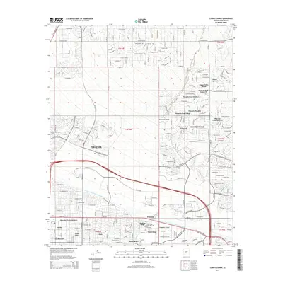
2014 Map of Currys Corner
USGS Topo · Published 2014About this map
The expanding northern reaches of Phoenix and Scottsdale meet in this 2014 survey, illustrating a landscape defined by master-planned communities and recreational infrastructure. The survey area is anchored by Currys Corner and an array of residential developments like Pinnacle Peak Village and Happy Valley Ranch that weave through the high desert. Modern water management is visible through the prominent path of the Central Arizona Project Aqueduct, while the historic agricultural footprint remains evidenced by the Old Verde Canal.
Find a feature on this map
46 named features on this map. Tap any name to fly to it.
Don’t see what you’re looking for? This feature index may not catch every label — zoom into the map to look around manually.
Map Details
Editions of this 2014 Currys Corner Map
This is the sole edition of this map. No revisions or reprints were ever made.
Other maps of this area

1904 · Camelback
USGS Topo · 1:62,500

1906 · Camelsback
USGS Topo · 1:62,500

1930 · Cave Creek
USGS Topo · 1:125,000

1939 · Cave Creek
USGS Topo · 1:125,000

1954 · Phoenix
USGS Topo · 1:250,000

1954 · Mesa
USGS Topo · 1:250,000

1957 · Mesa
USGS Topo · 1:250,000

1957 · Phoenix
USGS Topo · 1:250,000

1958 · Mesa
USGS Topo · 1:250,000

1958 · Phoenix
USGS Topo · 1:250,000