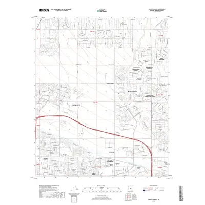
2018 Map of Currys Corner
USGS Topo · Published 2018About this map
Scottsdale Airport and the surrounding residential developments of northeastern Phoenix and Scottsdale define this 2018 landscape. The area is characterized by a dense network of suburban communities such as Pinnacle Peak Estates III, Windsong, and Basking Ridge. This map captures the intricate water management systems essential to the region's growth, most notably the prominent Central Arizona Project Aqueduct carving across the southern half of the sheet, and the trace of the Old Verde Canal. The terrain transitions from the structured suburban grids of Greenway Park V to the more open layouts of Happy Valley Ranch and Desert Highlands. Local transport is anchored by the 101 freeway, facilitating the rapid expansion of settlements like Oakhurst and Currys Corner.
Find a feature on this map
52 named features on this map. Tap any name to fly to it.
Don’t see what you’re looking for? This feature index may not catch every label — zoom into the map to look around manually.
Map Details
Editions of this 2018 Currys Corner Map
This is the sole edition of this map. No revisions or reprints were ever made.
Other maps of this area

1904 · Camelback
USGS Topo · 1:62,500

1906 · Camelsback
USGS Topo · 1:62,500

1930 · Cave Creek
USGS Topo · 1:125,000

1939 · Cave Creek
USGS Topo · 1:125,000

1954 · Phoenix
USGS Topo · 1:250,000

1954 · Mesa
USGS Topo · 1:250,000

1957 · Mesa
USGS Topo · 1:250,000

1957 · Phoenix
USGS Topo · 1:250,000

1958 · Mesa
USGS Topo · 1:250,000

1958 · Phoenix
USGS Topo · 1:250,000