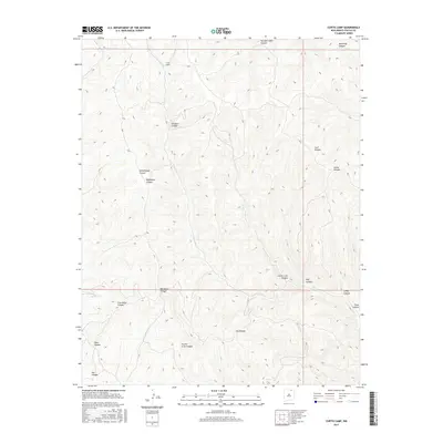
2017 Map of Curtis Camp
USGS Topo · Published 2017About this map
Curtis Camp sits at the head of a complex drainage network in this 2017 survey of the northern New Mexico high country. The landscape is defined by an intricate system of deep ravines and intermittent streams, where Crow Cr and its many tributaries carve through the plateau. The nomenclature of the terrain suggests a history of early ranching and resource extraction, with names like Rail Canyon, Coal Canyon, and Shotgun Canyon hinting at the practical concerns of those who first traversed these breaks. This modern digital survey by the U.S. Geological Survey provides a precise look at the topography surrounding Saltpeter Canyon and Five Dollar Canyon, where the elevation changes rapidly across the high mesas of Colfax County. The absence of paved roads or significant modern infrastructure emphasizes the remote and undisturbed character of this corner of the state.
Find a feature on this map
21 named features on this map. Tap any name to fly to it.
Don’t see what you’re looking for? This feature index may not catch every label — zoom into the map to look around manually.
Map Details
Editions of this 2017 Curtis Camp Map
This is the sole edition of this map. No revisions or reprints were ever made.
Other maps of this area

1915 · Brilliant
USGS Topo · 1:62,500

1915 · Koehler
USGS Topo · 1:62,500

1917 · Koehler
USGS Topo · 1:62,500

1954 · Raton
USGS Topo · 1:250,000

1955 · Cimarron
USGS Topo · 1:62,500

1958 · Raton
USGS Topo · 1:250,000

1962 · Casa Grande
USGS Topo · 1:62,500

1971 · Saltpeter Mountain
USGS Topo · 1:24,000
1971 · Curtis Camp
USGS Topo · 1:24,000
1971 · Red River Peak
USGS Topo · 1:24,000