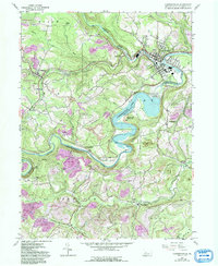
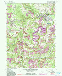
1959 Map of Curwensville
USGS Topo · Published 1993About this map
The West Branch Susquehanna River cuts a deep valley through Clearfield County, anchored by the borough of Curwensville. This map captures a landscape in transition, where the 1957 and 1959 surveys show the river's original path through Lumber City, later modified by the creation of Curwensville Lake and the Curwensville Dam. The surrounding hillsides are heavily marked by extractive industry, with numerous reclaimed strip mines and active strip mines dotting the plateaus between Anderson Creek and Little Clearfield Creek. Genealogists will find several rural burial grounds including Friends Cem, McClure Cem, and Ferguson Cem. Settlement patterns follow the valley floors and rail lines, with clusters at Grampian, Stronach, and New Millport. The presence of an Old Railroad Grade near Gazzam Run provides evidence of the area's earlier logging or coal-hauling infrastructure.
Find a feature on this map
59 named features on this map. Tap any name to fly to it.
Don’t see what you’re looking for? This feature index may not catch every label — zoom into the map to look around manually.
Map Details
Editions of this 1959 Curwensville Map
5 editions found
Other maps of this area

1903 · Curwensville
USGS Topo · 1:62,500

1903 · Houtzdale
USGS Topo · 1:62,500

1905 · Houtzdale
USGS Topo · 1:62,500

1929 · Clearfield
USGS Topo · 1:48,000

1929 · Penfield
USGS Topo · 1:62,500

1932 · Clearfield
USGS Topo · 1:62,500

1932 · Penfield
USGS Topo · 1:62,500

1939 · Curwensville
USGS Topo · 1:62,500

1942 · Curwensville
USGS Topo · 1:62,500

1943 · Punxsutawney
USGS Topo · 1:125,000