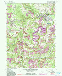
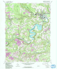
1959 Map of Curwensville
USGS Topo · Published 1990About this map
Curwensville and the winding W Br Susquehanna River anchor this topographic study of Clearfield County, Pennsylvania. The landscape is defined by the massive Curwensville Lake and the engineering of the Curwensville Dam, which drastically altered the natural flow of the river through the boroughs of Lumber City and Bridgeport. The region's industrial and geological character is evident in the numerous strip mines and Quarries that dot the surrounding hills, alongside natural landmarks like Bilger Rocks.
Find a feature on this map
53 named features on this map. Tap any name to fly to it.
Don’t see what you’re looking for? This feature index may not catch every label — zoom into the map to look around manually.
Map Details
Editions of this 1959 Curwensville Map
5 editions found
Other maps of this area

1903 · Curwensville
USGS Topo · 1:62,500

1903 · Houtzdale
USGS Topo · 1:62,500

1905 · Houtzdale
USGS Topo · 1:62,500

1929 · Clearfield
USGS Topo · 1:48,000

1929 · Penfield
USGS Topo · 1:62,500

1932 · Clearfield
USGS Topo · 1:62,500

1932 · Penfield
USGS Topo · 1:62,500

1939 · Curwensville
USGS Topo · 1:62,500

1942 · Curwensville
USGS Topo · 1:62,500

1943 · Punxsutawney
USGS Topo · 1:125,000