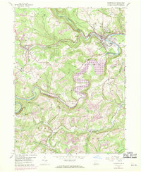
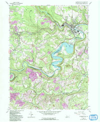
1959 Map of Curwensville
USGS Topo · Published 1970About this map
Curwensville Reservoir dominates the central landscape of this Clearfield County survey, winding through the valley created by the West Branch Susquehanna River. The map documents a significant era of transition as the Curwensville Dam and its resulting pool impacted established riverfront communities. Just downstream, the borough of Curwensville remains a hub of activity, featuring Irvin Park and an Athletic Field near the rail junction of the Baltimore and Ohio and Penn Central railroads.
Find a feature on this map
59 named features on this map. Tap any name to fly to it.
Don’t see what you’re looking for? This feature index may not catch every label — zoom into the map to look around manually.
Map Details
Editions of this 1959 Curwensville Map
5 editions found
Other maps of this area

1903 · Curwensville
USGS Topo · 1:62,500

1903 · Houtzdale
USGS Topo · 1:62,500

1905 · Houtzdale
USGS Topo · 1:62,500

1929 · Clearfield
USGS Topo · 1:48,000

1929 · Penfield
USGS Topo · 1:62,500

1932 · Clearfield
USGS Topo · 1:62,500

1932 · Penfield
USGS Topo · 1:62,500

1939 · Curwensville
USGS Topo · 1:62,500

1942 · Curwensville
USGS Topo · 1:62,500

1943 · Punxsutawney
USGS Topo · 1:125,000