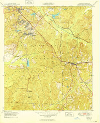
1949 Map of Cusseta
USGS Topo · Published 1949About this map
Fort Benning Military Reservation dominates this landscape, showing the intensive infrastructure of a major mid-century training ground. The map details an organized network of specialized facilities including the Stockade Hospital, a Landing Field, and a Sewage Disposal plant, reflecting the rapid expansion of the post during the 1940s. Beyond the Military Reservation Boundary, the town of Cusseta serves as the civilian hub, situated at the junction of the Seaboard Air Line railroad and local highways.
Find a feature on this map
32 named features on this map. Tap any name to fly to it.
Don’t see what you’re looking for? This feature index may not catch every label — zoom into the map to look around manually.
Map Details
Editions of this 1949 Cusseta Map
2 editions found
Other maps of this area

1908 · Columbus
USGS Topo · 1:62,500

1929 · Columbus
USGS Topo · 1:48,000

1947 · Columbus
USGS Topo · 1:62,500

1949 · Glen Alta
USGS Topo · 1:24,000

1949 · Julia
USGS Topo · 1:24,000

1949 · Ochillee
USGS Topo · 1:24,000

1949 · Buena Vista NW
USGS Topo · 1:24,000

1949 · Columbus
USGS Topo · 1:24,000

1949 · Cusseta
USGS Topo · 1:24,000

1950 · Fort Benning
USGS Topo · 1:24,000