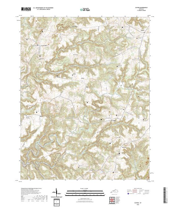
2022 Map of Custer
USGS Topo · Published 2022About this map
Hudson and Custer anchor the eastern landscape of this Breckinridge County study, where the terrain is deeply etched by the N-Fork-Rough River and its numerous tributaries. The map reveals a high density of family and community burial grounds, such as Cook Cem, Elliott Cem, and the Locust Hill United Methodist Church Cem, reflecting generations of rural settlement. These sites are linked by a network of winding local roads like the Locust Hill-Buras-Custer Rd that follow the contours of Marks Ridge and descend into Ivory Hollow. The presence of small settlements like Woodrow, Buras, and Mook alongside countless named branches and prongs, including Clear Prong and Muddy Prong, illustrates a landscape where life and transport were closely dictated by the drainage patterns of the Kentucky interior.
Find a feature on this map
97 named features on this map. Tap any name to fly to it.
Don’t see what you’re looking for? This feature index may not catch every label — zoom into the map to look around manually.
Map Details
Editions of this 2022 Custer Map
This is the sole edition of this map. No revisions or reprints were ever made.
Other maps of this area

1928 · Hardinsburg
USGS Topo · 1:48,000

1931 · Hardinsburg
USGS Topo · 1:62,500

1932 · Big Clifty
USGS Topo · 1:62,500

1941 · Ekron
USGS Topo · 1:62,500

1947 · Hardinsburg
USGS Topo · 1:24,000

1947 · Garfield
USGS Topo · 1:24,000

1947 · Hardinsburg
USGS Topo · 1:62,500

1947 · Ekron
USGS Topo · 1:62,500
1948 · Big Spring
USGS Topo · 1:24,000

1949 · Constantine
USGS Topo · 1:24,000