
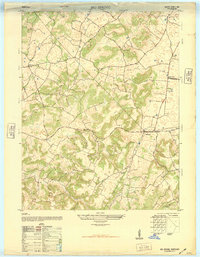
1953 Map of Custer
USGS Topo · Published 1954About this map
Marks Ridge and the winding course of the Rough River dominate this interior Kentucky landscape in the early 1950s. The settlement pattern is defined by small, ridge-top communities and valley outposts, connected by a network of unimproved roads and light-duty paths. Local life centers on rural institutions like Alexander Chapel, Leslie Chapel, and the New Salem Ch, which served as anchors for the surrounding farms. The mapping reveals a distinct educational footprint through the locations of the Shrewsbury Sch and Salem Sch. Notable water features like the North Fork Rough River and Fiddlers Creek carve deep valleys between the prominent heights of Locust Hill and Woodrow. This survey provides a clear view of the Breckinridge County and Hardin County border region before major modern infrastructure altered the rural character of communities such as Custer and Hudson.
Find a feature on this map
30 named features on this map. Tap any name to fly to it.
Don’t see what you’re looking for? This feature index may not catch every label — zoom into the map to look around manually.
Map Details
Editions of this 1953 Custer Map
This is the sole edition of this map. No revisions or reprints were ever made.
Other maps of this area

1928 · Hardinsburg
USGS Topo · 1:48,000

1931 · Hardinsburg
USGS Topo · 1:62,500

1932 · Big Clifty
USGS Topo · 1:62,500

1941 · Ekron
USGS Topo · 1:62,500

1947 · Hardinsburg
USGS Topo · 1:24,000

1947 · Garfield
USGS Topo · 1:24,000

1947 · Hardinsburg
USGS Topo · 1:62,500

1947 · Ekron
USGS Topo · 1:62,500
1948 · Big Spring
USGS Topo · 1:24,000

1949 · Constantine
USGS Topo · 1:24,000