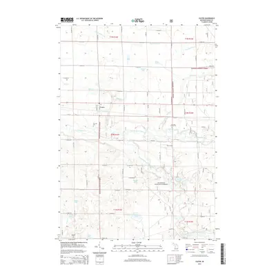
2014 Map of Custer
USGS Topo · Published 2014About this map
The village of Custer serves as the central hub of this Mason County landscape, situated where the Pere Marquette River begins its winding course through the northern reaches of the Manistee National Forest. The map documents a transition from the agricultural grid to the dense, wooded public lands of the forest, where the river meets the Big South Branch Pere Marquette River. Local genealogy and history are anchored by several community landmarks, including Riverside Cem near the riverbanks and Emmanuel Lutheran Cem further east. The terrain is characterized by numerous glacial kettle lakes and drainages, such as Whelan Lake, Saunders Lake, and the long Frog Paradise Drain. Aviation history is noted by the presence of Thorn Airport south of the main settlement, while the road network remains dominated by long, named rural routes like N Tuttle Rd and Wilson Rd.
Find a feature on this map
72 named features on this map. Tap any name to fly to it.
Don’t see what you’re looking for? This feature index may not catch every label — zoom into the map to look around manually.
Map Details
Editions of this 2014 Custer Map
This is the sole edition of this map. No revisions or reprints were ever made.
Other maps of this area

1931 · Custer NW
USGS Topo · 1:31,680

1931 · Custer SW
USGS Topo · 1:31,680

1931 · Custer NE
USGS Topo · 1:31,680

1931 · Manistee SE
USGS Topo · 1:31,680

1931 · Freesoil SW
USGS Topo · 1:31,680

1931 · Custer SE
USGS Topo · 1:31,680

1932 · Freesoil SE
USGS Topo · 1:31,680

1932 · Ludington NE
USGS Topo · 1:31,680

1932 · Ludington SE
USGS Topo · 1:31,680

1954 · Milwaukee
USGS Topo · 1:250,000