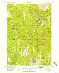
1956 Map of Custer
USGS Topo · Published 1956About this map
The town of Custer and its industrial surroundings are captured here in the mid-1950s, a period when the timber and mining economies of the Black Hills were well-established. The map documents a rugged landscape punctuated by the Chicago Burlington and Quincy railroad, which served remote settlements like Tigerville, Oreville, and Redfern. A significant cultural landmark of the era is the Crazy Horse Carving on Thunderhead Mountain, shown in its early stages of development.
Find a feature on this map
105 named features on this map. Tap any name to fly to it.
Don’t see what you’re looking for? This feature index may not catch every label — zoom into the map to look around manually.
Map Details
Editions of this 1956 Custer Map
2 editions found
Other maps of this area

1893 · Rapid
USGS Topo · 1:125,000

1894 · Deadwood
USGS Topo · 1:125,000

1894 · Hermosa
USGS Topo · 1:125,000

1896 · Harney Peak
USGS Topo · 1:125,000

1898 · Rapid
USGS Topo · 1:125,000

1901 · Hermosa
USGS Topo · 1:125,000

1901 · Harney Peak
USGS Topo · 1:125,000

1901 · Deadwood
USGS Topo · 1:125,000

1903 · Rapid
USGS Topo · 1:125,000

1916 · Deadwood
USGS Topo · 1:125,000