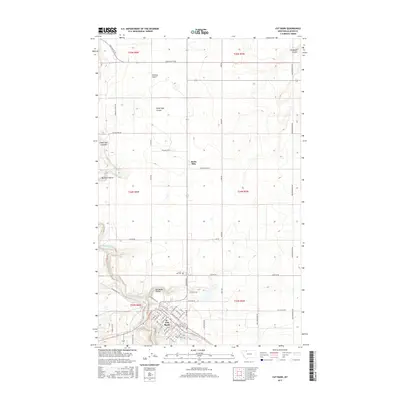
2017 Map of Cut Bank
USGS Topo · Published 2017About this map
Cut Bank serves as the primary hub of this northern Montana landscape, situated along the Cut Bank Creek where the terrain begins to break into a series of distinctive coulees. The town's grid is defined by its proximity to the BN Right Of Way, reflecting the long-standing importance of the rail line to the local economy. To the north, the small settlement of Santa Rita sits amidst a high plain marked by drainage features like Ottawa Gulch, Head Light Coulee, and Big Rock Coulee.
Find a feature on this map
64 named features on this map. Tap any name to fly to it.
Don’t see what you’re looking for? This feature index may not catch every label — zoom into the map to look around manually.
Map Details
Editions of this 2017 Cut Bank Map
This is the sole edition of this map. No revisions or reprints were ever made.
Other maps of this area

1907 · Blackfoot Res.
USGS Topo · 1:48,000

1909 · Cut Bank
USGS Topo · 1:125,000

1912 · Cut Bank
USGS Topo · 1:125,000

1960 · Cut Bank
USGS Topo · 1:250,000

1963 · Cut Bank
USGS Topo · 1:250,000

1964 · Cut Bank
USGS Topo · 1:250,000

1966 · Ethridge NW
USGS Topo · 1:24,000
1966 · Boru Spring
USGS Topo · 1:24,000
1966 · Cut Bank
USGS Topo · 1:24,000
1966 · Cut Bank SE
USGS Topo · 1:24,000