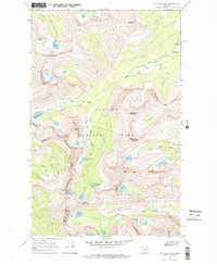
1968 Map of Cut Bank Pass
USGS Topo · Published 1971About this map
Glacier National Park reveals its high-altitude hydrology and complex relief in this late 1960s survey, dominated by the Continental Divide as it separates the Atlantic and Pacific watersheds. The terrain is marked by numerous glacial cirques containing high-elevation water bodies like Medicine Grizzly Lake and the poetically named Lake of the Seven Winds below McClintock Peak.
Find a feature on this map
46 named features on this map. Tap any name to fly to it.
Don’t see what you’re looking for? This feature index may not catch every label — zoom into the map to look around manually.
Map Details
Editions of this 1968 Cut Bank Pass Map
2 editions found
Other maps of this area

1901 · Browning
USGS Topo · 1:125,000

1903 · Browning
USGS Topo · 1:125,000

1904 · Chief Mountain
USGS Topo · 1:125,000

1913 · Marias Pass
USGS Topo · 1:125,000

1914 · Nyack
USGS Topo · 1:125,000

1938 · Chief Mountain
USGS Topo · 1:125,000

1960 · Cut Bank
USGS Topo · 1:250,000

1963 · Cut Bank
USGS Topo · 1:250,000

1964 · Cut Bank
USGS Topo · 1:250,000
1964 · Mount Saint Nicholas
USGS Topo · 1:24,000