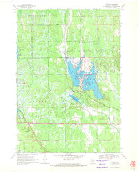
1969 Map of Cutler
USGS Topo · Published 1971About this map
The Little Yellow River and South Branch Yellow River define this central Wisconsin landscape, characterized by an extensive network of managed wetlands and conservation lands in the late 1960s. This survey documents the intersection of several major preserves, including the Necedah National Wildlife Refuge, Meadow Valley State Wildlife Area, and Kingston State Wildlife Area. The hydrology is heavily modified for wildlife management, featuring engineered bodies of water like Rynearson Pool No 1, Rynearson Pool No 2, and the Suk and Cerney Flowage. The small settlement of Cutler sits along the southern edge, positioned near the Chicago and North Western rail line and 22d Street. This map is particularly valuable for its detail on the refuge infrastructure, noting features such as the Wildlife Headquarters and an Observation Tower near Beaver Ridge.
Find a feature on this map
29 named features on this map. Tap any name to fly to it.
Don’t see what you’re looking for? This feature index may not catch every label — zoom into the map to look around manually.
Map Details
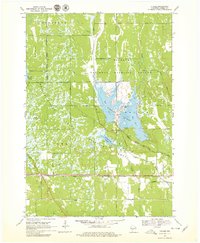
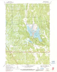
Editions of this 1969 Cutler Map
3 editions found
Other maps of this area

1919 · Kendall
USGS Topo · 1:62,500

1921 · Mauston
USGS Topo · 1:62,500

1921 · Kendall
USGS Topo · 1:62,500

1953 · Eau Claire
USGS Topo · 1:250,000

1958 · Eau Claire
USGS Topo · 1:250,000

1958 · Necedah
USGS Topo · 1:48,000

1958 · Wyeville
USGS Topo · 1:48,000

1958 · La Crosse
USGS Topo · 1:250,000

1961 · La Crosse
USGS Topo · 1:250,000

1962 · Kendall
USGS Topo · 1:62,500