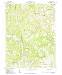
1961 Map of Cutler
USGS Topo · Published 1963About this map
Wayne National Forest dominates the hilly terrain of this 1961 survey, where the Hocking River carves a deep valley through the southern half of the quadrangle. The Baltimore and Ohio Railroad tracks follow the river's bend past Frost, while another line snakes through the northern hills toward Cutler. This area is dense with family history, marked by numerous small burial grounds such as Harris Cem, Sawyer Cem, and Barrows Cem. These names often correspond to local geography, including Haga Ridge and Cubbison Ridge.
Find a feature on this map
66 named features on this map. Tap any name to fly to it.
Don’t see what you’re looking for? This feature index may not catch every label — zoom into the map to look around manually.
Map Details
Editions of this 1961 Cutler Map
3 editions found
Other maps of this area

1902 · Parkersburg
USGS Topo · 1:62,500

1904 · Parkersburg
USGS Topo · 1:62,500

1904 · Chesterhill
USGS Topo · 1:62,500

1906 · Belleville
USGS Topo · 1:62,500

1906 · Chesterhill
USGS Topo · 1:62,500

1907 · Keno
USGS Topo · 1:62,500

1924 · Belleville
USGS Topo · 1:62,500

1926 · Belleville
USGS Topo · 1:62,500

1949 · Clarksburg
USGS Topo · 1:250,000

1956 · Clarksburg
USGS Topo · 1:250,000