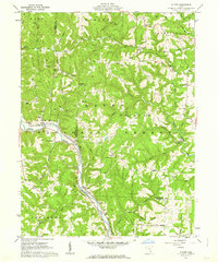
1961 Map of Cutler
USGS Topo · Published 1963About this map
The Hocking River winds through this early 1960s landscape, serving as a corridor for the Baltimore and Ohio Railroad as it passes through Frost. The region is defined by its deep incorporation into the Wayne National Forest, where steep ridges like Haga Ridge and Cubbison Ridge separate numerous small drainage runs. Small settlements such as Cutler and Decaturville serve as local hubs, characterized by a high density of country churches and family burial grounds, including the Mount Liberty Cem and Harris Cem.
Find a feature on this map
78 named features on this map. Tap any name to fly to it.
Don’t see what you’re looking for? This feature index may not catch every label — zoom into the map to look around manually.
Map Details
Editions of this 1961 Cutler Map
3 editions found
Other maps of this area

1902 · Parkersburg
USGS Topo · 1:62,500

1904 · Parkersburg
USGS Topo · 1:62,500

1904 · Chesterhill
USGS Topo · 1:62,500

1906 · Belleville
USGS Topo · 1:62,500

1906 · Chesterhill
USGS Topo · 1:62,500

1907 · Keno
USGS Topo · 1:62,500

1924 · Belleville
USGS Topo · 1:62,500

1926 · Belleville
USGS Topo · 1:62,500

1949 · Clarksburg
USGS Topo · 1:250,000

1956 · Clarksburg
USGS Topo · 1:250,000