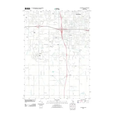
2011 Map of Cutlerville
USGS Topo · Published 2011About this map
Byron Center and Cutlerville anchor this 2011 survey of Kent County, Michigan, where suburban expansion meets legacy agricultural drainage systems. The landscape is defined by the Buck Creek watershed and the Dorr and Byron Drain, illustrating the region's historical reliance on managed waterways for land use. Genealogists will find a high density of burial sites across the township, including Winchester Cemetery, Boynton Cemetery, Blain Cemetery, and the Kent Memorial Gardens. These sites, along with smaller family-named landmarks like Weaver Cemetery and Jones Cemetery, provide a detailed geographic record of the area's early settlers. The map also highlights the transition toward recreation and modern infrastructure, featuring multiple golf courses such as The Pines Golf Course and Maple Hills Golf Course, alongside smaller outlying settlements like Corinth and Ross.
Find a feature on this map
54 named features on this map. Tap any name to fly to it.
Don’t see what you’re looking for? This feature index may not catch every label — zoom into the map to look around manually.
Map Details
Editions of this 2011 Cutlerville Map
This is the sole edition of this map. No revisions or reprints were ever made.
Other maps of this area

1914 · Grand Rapids
USGS Topo · 1:62,500

1943 · Grand Rapids
USGS Topo · 1:62,500

1958 · Allegan
USGS Topo · 1:62,500

1958 · Grandville
USGS Topo · 1:62,500

1958 · Grandville
USGS Topo · 1:24,000

1958 · Grand Rapids
USGS Topo · 1:250,000

1959 · Wayland
USGS Topo · 1:62,500

1961 · Grand Rapids
USGS Topo · 1:250,000

1962 · Grand Rapids
USGS Topo · 1:250,000
1967 · Grand Rapids West
USGS Topo · 1:24,000