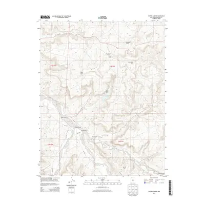
2013 Map of Cutter Canyon
USGS Topo · Published 2013About this map
Manzanares Mesa dominates the high ground of this high-desert landscape in the early 21st century, deeply etched by a complex network of drainages. The industrial footprint of energy extraction is visible across the terrain, notably within the San Juan Basin Gas Field, where roads like Road 4450 and CO Road 7007 navigate the plateaus and canyon floors. Hydrological features such as the Cutter Reservoir and the Cutter Lake Arch provide localized water management in an otherwise arid environment. The map details the convergence of several major drainages, including Blanco Canyon and Carrizo Canyon, which serve as primary conduits for seasonal runoff and historical transit routes through the San Juan County backcountry. Smaller tributaries like Medina Canyon and Escarbada Canyon branch off these larger systems, illustrating the intricate geological erosion patterns of the region.
Find a feature on this map
22 named features on this map. Tap any name to fly to it.
Don’t see what you’re looking for? This feature index may not catch every label — zoom into the map to look around manually.
Map Details
Editions of this 2013 Cutter Canyon Map
This is the sole edition of this map. No revisions or reprints were ever made.
Other maps of this area

1889 · Largo
USGS Topo · 1:250,000

1895 · Largo
USGS Topo · 1:250,000

1954 · Pine River
USGS Topo · 1:24,000

1954 · Aztec
USGS Topo · 1:250,000

1958 · Aztec
USGS Topo · 1:250,000

1959 · Gould Pass
USGS Topo · 1:62,500

1959 · Aztec
USGS Topo · 1:62,500

1959 · Navajo Dam
USGS Topo · 1:62,500

1960 · Bloomfield
USGS Topo · 1:62,500

1962 · Aztec
USGS Topo · 1:250,000