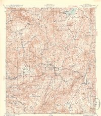
1954 Map of Cuyamaca Peak
USGS Topo · Published 1954About this map
The high backcountry of San Diego County is centered on the towering Cuyamaca Pk and the expansive Cuyamaca Rancho State Park. This mid-century survey details a landscape of transition where cattle ranches like Burney Ranch and Harper Ranch operated alongside established wilderness preserves and two significant indigenous lands: the Capitan Grande Indian Reservation and Viejas Indian Reservation. The geography is defined by steep relief, from the heights of Stonewall Pk down into the Sweetwater River drainage.
Find a feature on this map
68 named features on this map. Tap any name to fly to it.
Don’t see what you’re looking for? This feature index may not catch every label — zoom into the map to look around manually.
Map Details
Editions of this 1954 Cuyamaca Peak Map
This is the sole edition of this map. No revisions or reprints were ever made.
Other maps of this area

1893 · El Cajon
USGS Topo · 1:62,500

1901 · Elcajon
USGS Topo · 1:62,500

1903 · Cuyamaca
USGS Topo · 1:125,000

1903 · Elcajon
USGS Topo · 1:62,500

1903 · Ramona
USGS Topo · 1:125,000

1904 · Southern California Sheet No. 2
USGS Topo · 1:250,000

1931 · Vallecito
USGS Topo · 1:125,000

1931 · Carrizo
USGS Topo · 1:125,000

1939 · El Cajon
USGS Topo · 1:62,500

1939 · Campo
USGS Topo · 1:62,500