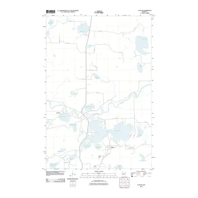
2010 Map of Cuyuna
USGS Topo · Published 2010About this map
The Mississippi River winds through this central Minnesota landscape, where the iron-mining legacy of the Cuyuna Range is visible in the presence of the Yawkey Mine. At the time of this 2010 survey, the settlement of Cuyuna sits at a critical junction of local waterways, including the expansive Rabbit Lake and Mud Lake. The terrain is defined by a dense network of glacial lakes and wetlands, connected by the Rabbit River and Little Pine River.
Find a feature on this map
50 named features on this map. Tap any name to fly to it.
Don’t see what you’re looking for? This feature index may not catch every label — zoom into the map to look around manually.
Map Details
Editions of this 2010 Cuyuna Map
This is the sole edition of this map. No revisions or reprints were ever made.
Other maps of this area

1912 · Deerwood
USGS Topo · 1:62,500

1913 · Cuyuna
USGS Topo · 1:62,500

1914 · Deerwood
USGS Topo · 1:62,500

1915 · Cuyuna
USGS Topo · 1:62,500

1915 · Brainerd
USGS Topo · 1:62,500

1918 · Brainerd
USGS Topo · 1:62,500

1953 · Duluth
USGS Topo · 1:250,000

1953 · Brainerd
USGS Topo · 1:250,000

1957 · Brainerd
USGS Topo · 1:250,000

1958 · Brainerd
USGS Topo · 1:250,000