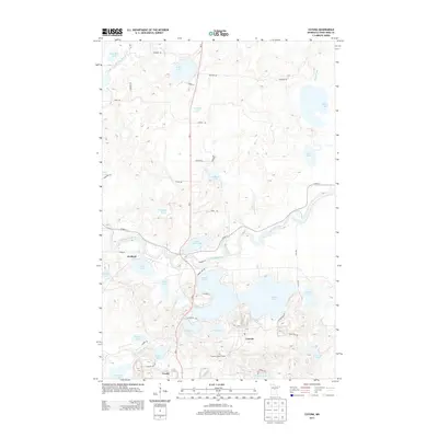
2013 Map of Cuyuna
USGS Topo · Published 2013About this map
The Mississippi River winds through this central Minnesota landscape, defining a terrain shaped by its glacial past and industrial heritage. The settlements of Cuyuna, Wolford, and the northern edge of Crosby are the primary population centers, situated amidst a dense network of water bodies including the large Rabbit Lake and the smaller Indian Jack Lake. The presence of the Cuyuna Lookout Tower south of Mud Lake signifies the area's forest management history, while the proximity of numerous named basins like Deadmans Lake and Clinker Lake speaks to the region's complex hydrology. The map details a transition from the river valley to the upland lakes, with roads such as Iron Hub Rd and Co Hwy-11 connecting these small communities. This survey documents the area's modern footprint, providing a clear view of the residential and natural features that characterize the Crow Wing County lake country.
Find a feature on this map
55 named features on this map. Tap any name to fly to it.
Don’t see what you’re looking for? This feature index may not catch every label — zoom into the map to look around manually.
Map Details
Editions of this 2013 Cuyuna Map
This is the sole edition of this map. No revisions or reprints were ever made.
Other maps of this area

1912 · Deerwood
USGS Topo · 1:62,500

1913 · Cuyuna
USGS Topo · 1:62,500

1914 · Deerwood
USGS Topo · 1:62,500

1915 · Cuyuna
USGS Topo · 1:62,500

1915 · Brainerd
USGS Topo · 1:62,500

1918 · Brainerd
USGS Topo · 1:62,500

1953 · Duluth
USGS Topo · 1:250,000

1953 · Brainerd
USGS Topo · 1:250,000

1957 · Brainerd
USGS Topo · 1:250,000

1958 · Brainerd
USGS Topo · 1:250,000